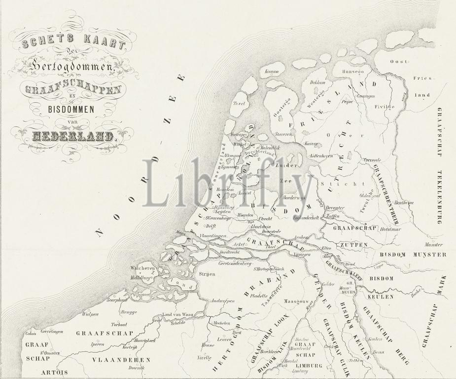
Amsterdam, Binger, Charles, Netherlands, Hofdijk, Willem Jacob, Sketch map of the duchies, counties and bishoprics of the Netherlands, Historical map of the duchies, counties and bishoprics of the Netherlands. Placed by Muller at the beginning of the thirteenth century., print, picture, map, history print, prints, Frederik Muller History plates, height 200 mm, width 240 mm, 1816-06-27 - 1888-08-29, intermediary draughtsman, after a drawing by, 1853 - 1861, third quarter 19th century, paper, lithography (technique), Dutch, 1830-02-25 - 1916, printer
Keywords:
Amsterdam, Binger, Charles, Netherlands, Hofdijk, Willem Jacob, Sketch map, duchies, counties, bishoprics, Historical map, Placed, Muller, thirteenth century, print, picture, map, history print, prints, Frederik Muller History plates, height 200 mm, width 240 mm, 1816-06-27 - 1888-08-29, intermediary draughtsman, drawing, 1853 - 1861, third quarter 19th century, paper, lithography, technique, Dutch, 1830-02-25 - 1916, printer
Image ID:
The watermark in the image will not appear on the final download.