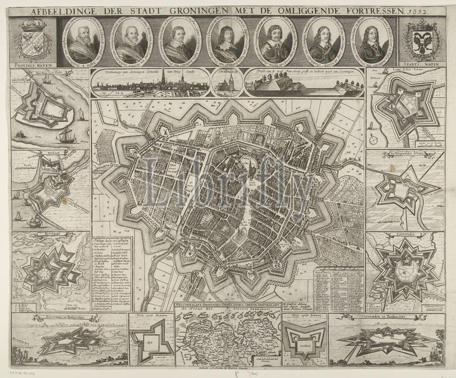
Amsterdam, Doncker, Hendrick (I), Pieman, Samuel, Haubois, Egbert, Northern Netherlands, Savery, Salomon, Image of the City of Groningen with the surrounding Fortresses. 1652, Map of Groningen, 1652, Map of the city of Groningen. In the middle a map of the city, around this representations of ten fortresses in the area. At the bottom also a map of the northern Dutch provinces. At the top portraits of seven stadtholders of Groningen., print, drawing, map, prints, Frederik Muller Historieplaten, height 463 mm, width 610 mm, 1594 - 1683-10-16, print maker, printmaker, 1652 - 1652, third quarter 17th century, paper, papier, etching, etchings, engraving, engraving (printing process), Netherlands, 1610 - 1653, intermediary draughtsman, after a drawing by, Publication (Event), Publication, publisher, 1626 - 1699
Keywords:
Amsterdam, Doncker, Hendrick, I, Pieman, Samuel, Haubois, Egbert, Northern Netherlands, Savery, Salomon, Image, City, Groningen, surrounding Fortresses, 1652, Map, city, middle, map, representations, ten fortresses, area, bottom also, northern Dutch provinces, top portraits, seven stadtholders, print, drawing, prints, Frederik Muller Historieplaten, height 463 mm, width 610 mm, 1594 - 1683-10-16, print maker, printmaker, 1652 - 1652, third quarter 17th century, paper, papier, etching, etchings, engraving, printing process, Netherlands, 1610 - 1653, intermediary draughtsman, Publication, Event, publisher, 1626 - 1699
Image ID:
The watermark in the image will not appear on the final download.