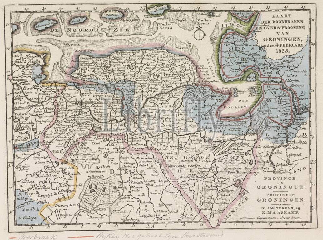
Amsterdam, Maaskamp, Evert, Netherlands, Five maps of the areas affected by flooding in 1825, Province de Groninguee, Province of Groningen, Map of the Breakthroughs and Flooding of Groningen, on 4 February 1825, Map of the area in Groningen affected by the floods in 1825, verso - stamped, Map of the province of Groningen and German East Friesland, showing in blue the areas affected by the floods in February 1825 and in red the places where the dikes were breached. At the bottom of the page a line of manuscript. Part of a series of five maps of the affected areas., print, image, map, prints, images, Frederik Muller Historieplaten, height 180 mm, width 245 mm, print maker, printmaker, 1825 - 1825, paper, engraving, engraving (printing process), hand colouring, Publication (Event), Publication, Noord-Nederlands, 1769-09-27 - 1834-01-31, publisher
Keywords:
Amsterdam, Maaskamp, Evert, Netherlands, Five maps, areas affected, flooding, 1825, Province de Groninguee, Province, Groningen, Map, Breakthroughs, Flooding, 4 February 1825, area, Groningen affected, floods, verso - stamped, province, German East Friesland, showing, blue, February 1825, red, places, dikes, breached, bottom, page, line, manuscript, Part, series, five maps, affected areas, print, image, map, prints, images, Frederik Muller Historieplaten, height 180 mm, width 245 mm, print maker, printmaker, 1825 - 1825, paper, engraving, printing process, hand colouring, Publication, Event, Noord-Nederlands, 1769-09-27 - 1834-01-31, publisher
Image ID:
The watermark in the image will not appear on the final download.