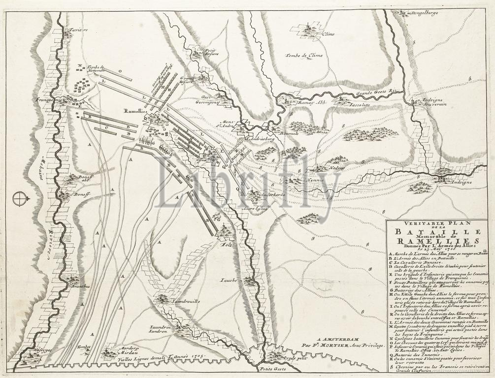
Amsterdam, Mortier, Pieter (I), Noordelijke Nederlanden, Bataille Memorable de Ramellies, Veritable Plan de la Bataille Memorable de Ramellies Donnée Par l'Armée des Allies le 23. May 1706, Slag bij Ramillies, 1706, Northern Netherlands, Map of the Battle of Ramillies between the Allies under the Duke of Marlborough and the Lord of Ouwerkerk and the French and Spanish under the Elector of Bavaria and the Duke of Villeroy, 23 May 1706. Printed on the sheet below the plate a text in 4 columns in French and Dutch., print, prent, nieuwsprent, prints, prenten, Frederik Muller Historieplaten, height 580 mm, width 474 mm, print maker, prentmaker, 1706 - 1706, paper, papier, engraving, engraving (printing process), letterpress printing, letterpress, Publication (Event), Publication, French, 1661 - 1711, publisher
Keywords:
Amsterdam, Mortier, Pieter, I, Noordelijke Nederlanden, Bataille Memorable de Ramellies, Veritable Plan de la Bataille Memorable de Ramellies Donnée Par, le, 23, 1706, Slag bij Ramillies, Northern Netherlands, Map, Battle, Ramillies, Allies under, Duke, Marlborough, Lord, Ouwerkerk, French, Spanish under, Elector, Bavaria, Villeroy, Printed, sheet, plate, text, 4 columns, Dutch, print, prent, nieuwsprent, prints, prenten, Frederik Muller Historieplaten, height 580 mm, width 474 mm, print maker, prentmaker, 1706 - 1706, paper, papier, engraving, printing process, letterpress printing, letterpress, Publication, Event, 1661 - 1711, publisher
Image ID:
The watermark in the image will not appear on the final download.