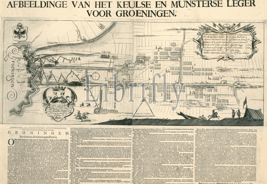
Groningen, Fossema, Gerrit Klaessen, Roosingh, Hendrick Cornelis, Bierum, Hendrik, Feltman, J., Fries, Jan D., Map of the Siege and Breakup of the Bishops of Collen and Munster before the City of Groningen Captured on 9 July, Concluded on 16 August, Illustration of the Cologne and Munster Army before Groeningen, Siege of Groningen on the East Side, 1672, Sheet with an illustration and description of the siege of Groningen in July-August 1672. The representation shows a map with the lines of the besieging troops for the eastern side of the city. The map was drawn up by the engineers J. Feltman and H. Bierum. Below the representation, in four columns, is the 'Journal of Daily Accounts, of what has passed about the Siege of the City of Groningen both outside and inside.', print, news print, prints, Frederik Muller Historieplaten, height 485 mm, width 695 mm, print maker, printmaker, 1672 - 1672, third quarter 17th century, paper, papier, engraving, engraving (printing process), letterpress printing, cartographer, Northern Netherlands, Publication (Event), Publication, publisher
Keywords:
Groningen, Fossema, Gerrit Klaessen, Roosingh, Hendrick Cornelis, Bierum, Hendrik, Feltman, J, Fries, Jan D, Map, Siege, Breakup, Bishops, Collen, Munster, City, Groningen Captured, 9 July, Concluded, 16 August, Illustration, Cologne, Munster Army, Groeningen, East Side, 1672, Sheet, illustration, description, siege, July-August 1672, representation, map, lines, besieging troops, eastern side, city, was, drawn up, engineers J, H, four columns, Journal, Daily Accounts, passed, outside, inside, print, news print, prints, Frederik Muller Historieplaten, height 485 mm, width 695 mm, print maker, printmaker, 1672 - 1672, third quarter 17th century, paper, papier, engraving, printing process, letterpress printing, cartographer, Northern Netherlands, Publication, Event, publisher
Image ID:
The watermark in the image will not appear on the final download.