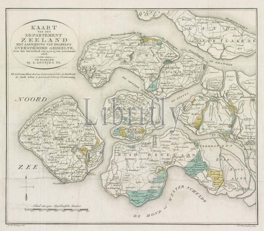
Haarlem, Loosjes, Adriaan Pietersz., Verkuyl, JM, Netherlands, Veelwaard, Daniël (I), Map of the Department of Zeeland with an indication of its flooded area, by the flood of 14 and 16 January 1808, Map of Zeeland with the flooded areas, 1808, verso - stamped, Map of the Department of Zeeland showing the areas that were flooded during the flood of 14-15 January 1808., print, map, prints, Frederik Muller Historieplaten, height 347 mm, width 396 mm, Noord-Nederlands, 1766-08-14 - 1851-02-28, print maker, printmaker, 1808 - 1810, paper, papier, etching, etchings, engraving, engraving (printing process), hand coloring, intermediary draughtsman, after a drawing by, Publication (Event), Publication, Dutch, 1761-05-13 - 1818-02-28, publisher
Keywords:
Haarlem, Loosjes, Adriaan Pietersz, Verkuyl, Jm, Netherlands, Veelwaard, Daniël, I, Map, Department, Zeeland, indication, flooded area, flood, 14, 16 January 1808, flooded areas, 1808, verso - stamped, Zeeland showing, areas, flooded, 14-15 January 1808, print, map, prints, Frederik Muller Historieplaten, height 347 mm, width 396 mm, Noord-Nederlands, 1766-08-14 - 1851-02-28, print maker, printmaker, 1808 - 1810, paper, papier, etching, etchings, engraving, printing process, hand coloring, intermediary draughtsman, drawing, Publication, Event, Dutch, 1761-05-13 - 1818-02-28, publisher
Image ID:
The watermark in the image will not appear on the final download.