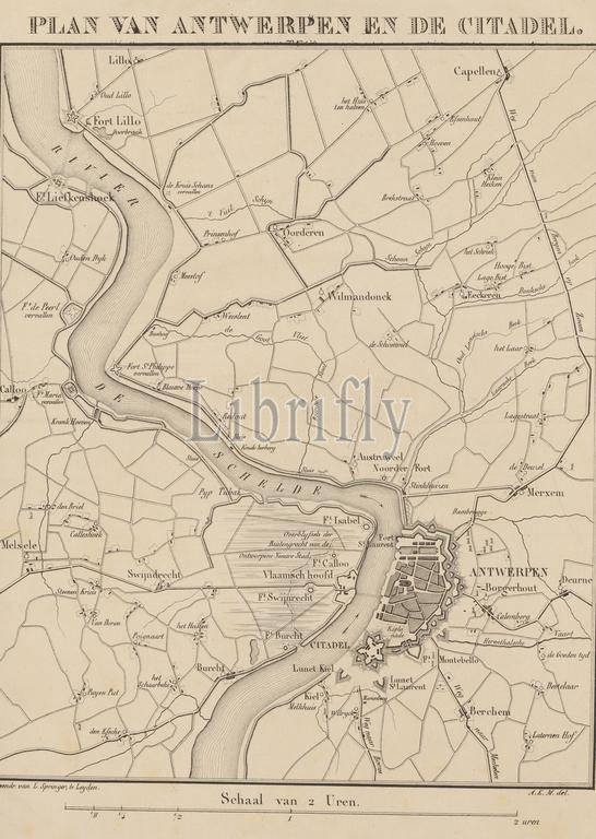
Map of Antwerp and the Citadel, 1832, Plan of Antwerp and the Citadel (title on object), Map of Antwerp and the Citadel, at the time of the siege of Antwerp in December 1832., print maker: Leendert Springer (I), after drawing by: Monogrammist A.E.M., print maker: Leiden, after drawing by: Netherlands, 1832 - 1833, paper, height 455 mm × width 364 mm, print
Keywords:
Map, Antwerp, Citadel, 1832, Plan, title, object, time, siege, December 1832, print maker, Leendert Springer, I, drawing, Monogrammist A.E.M, Leiden, Netherlands, 1832 - 1833, paper, height 455 mm ×, width, 364 mm, print
Image ID:
The watermark in the image will not appear on the final download.