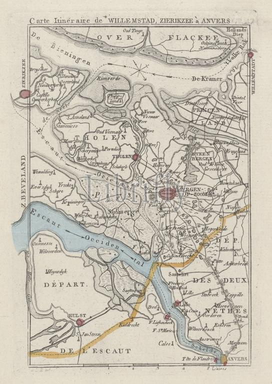
Map of the area around Bergen op Zoom, ca. 1830, Carte Itinéraire de Willemstad, Zierikzee à Anvers (title on object), Map of the area around Bergen op Zoom, ca. 1830. Possibly at the time of the bombardment of Antwerp, 27 October 1830., print, print maker: anonymous, after drawing by: Monogrammist JBDB, (mentioned on object), publisher: Evert Maaskamp, (attributed to), print maker: Belgium, publisher: Amsterdam, 1830 - 1831, paper, etching, engraving, height, 168 mm × width, 116 mm
Keywords:
Map, area, Bergen op Zoom, ca, 1830, Carte Itinéraire de Willemstad, Zierikzee à Anvers, title, object, time, bombardment, Antwerp, 27 October 1830, print, print maker, anonymous, drawing, Monogrammist JBDB, mentioned, publisher, Evert Maaskamp, attributed, Belgium, Amsterdam, 1830 - 1831, paper, etching, engraving, height, 168 mm × width, 116 mm
Image ID:
The watermark in the image will not appear on the final download.