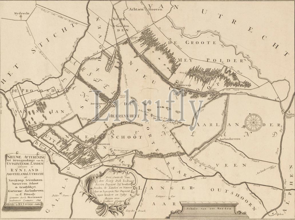
Map of the ceded lands around Nieuwkoop, Zevenhoven, Nieuwveen, Korteraar and Aarlanderveen, New delineation for the reclamation of the ceded lands located in Rynland, Amstelland, & Utrecht as Nieukoop, Sevenhoven, Nieuveen, Schoot, de graaflykheyt Korteraar, Aarlanderveen, and d' Proosdy (title on object), Map of the peat lands around Nieuwkoop, Zevenhoven, Nieuwveen, Korteraar and Aarlanderveen. Bottom left the title cartouche. To the right of this is a cartouche with geometric information. Bottom right a scale stick: Scale of 800 rods. Orientation: north left., print maker: anonymous, Lodewijk Kraakhorst, publisher: Reinier Ottens (I) & Josua, Amsterdam, 1742, paper, engraving, etching, height 415 mm × width 567 mm, print
Keywords:
Map, ceded lands, Nieuwkoop, Zevenhoven, Nieuwveen, Korteraar, Aarlanderveen, New delineation, reclamation, ceded, lands, located, Rynland, Amstelland, & Utrecht, Nieukoop, Sevenhoven, Nieuveen, Schoot, de graaflykheyt Korteraar, d, Proosdy, title, object, peat lands, Bottom left, title cartouche, right, cartouche, geometric information, Bottom right, scale stick, Scale, 800 rods, Orientation, north left, print maker, anonymous, Lodewijk Kraakhorst, publisher, Reinier Ottens, I, & Josua, Amsterdam, 1742, paper, engraving, etching, height 415 mm ×, width, 567 mm, print
Image ID:
The watermark in the image will not appear on the final download.