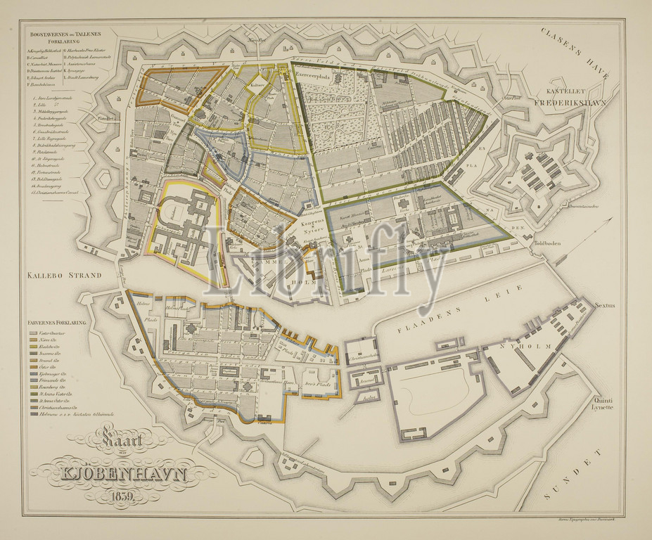
Map of Copenhagen 1839, 1874, Graphic Art, Lithograph, It was a small town of some 120,000 inhabitants to which Thorvaldsen returned in 1838. In addition to the Sound to the east, the city was defined by the ramparts, the jagged structures on the map, that defined its extent. The Town Hall Square is today at the absolute centre of the city. In 1838, on the other hand, it was outside the ramparts., Paper, Color, Printer's ink, Lithography, Printet, Height (paper size) 500 mm, Width (paper size) 620 mm, Trykt ved Geodætisk Institut 1874, Storms Topographie over Danmark, Graphic Design, European, Modernity (1800 - 1914), Printer, Geodætisk Institut
Keywords:
Map, Copenhagen 1839, 1874, Graphic Art, Lithograph, small town, 120, 000 inhabitants, Thorvaldsen returned, 1838, addition, Sound, east, city, defined, ramparts, jagged structures, map, defined, extent, Town Hall Square, today, absolute centre, city, 1838, hand, outside, ramparts, Paper, Color, Printer's ink, Lithography, Printet, Height, paper size, 500 mm, Width, paper size, 620 mm, Trykt ved Geodætisk Institut 1874, Storms Topographie, Danmark, Graphic Design, European, Modernity, 1800, 1914, Printer, Geodætisk Institut
Image ID:
The watermark in the image will not appear on the final download.