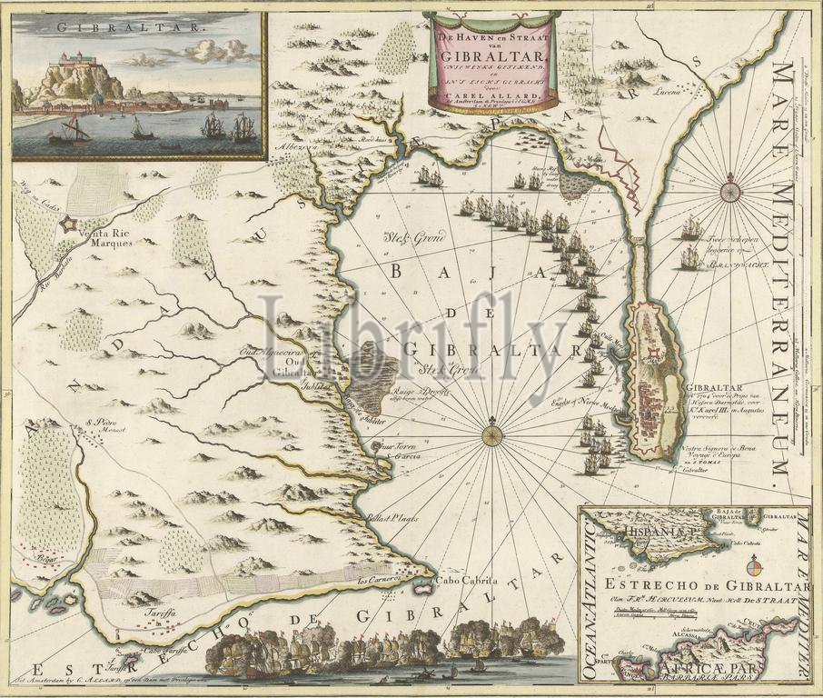
Map of Gibraltar, 1704, The Harbor and Strait of Gibraltar (title on object), Map of Gibraltar with the ships of the Allies in front of the port of Gibraltar, captured on August 3, 1704. Top left an inset with a view of the Rock of Gibraltar, bottom right an inset with a map of southern Spain and North Africa. At the bottom a sea battle., print, print maker: Carel Allard, (workshop of), after drawing by: Carel Allard, (mentioned on object), publisher: Carel Allard, (mentioned on object), Amsterdam, 1704, paper, etching, engraving, height, 511 mm × width, 600 mm
Keywords:
Map, Gibraltar, 1704, Harbor, Strait, title, object, ships, Allies, front, port, captured, August 3, Top left, inset, view, Rock, bottom right, map, southern Spain, North Africa, bottom, sea battle, print, print maker, Carel Allard, workshop of, drawing, mentioned, publisher, Amsterdam, paper, etching, engraving, height, 511 mm × width, 600 mm
Image ID:
The watermark in the image will not appear on the final download.