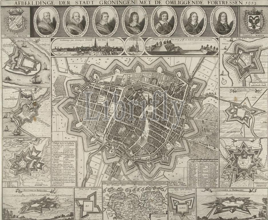
Map of Groningen, 1652, Images of the City of Groningen with the surrounding Fortresses. 1652 (title on object), Map of the city of Groningen. In the middle is a map of the city, surrounded by representations of ten fortresses in the area. At the bottom there is also a map of the northern Dutch provinces. At the top portraits of seven governors of Groningen., print, print maker: Salomon Savery, (signed by artist), after drawing by: Egbert Haubois, (mentioned on object), publisher: Samuel Pieman, (mentioned on object), print maker: Northern Netherlands, publisher: Amsterdam, 1652, paper, etching, engraving, height, 463 mm × width, 610 mm
Keywords:
Map, Groningen, 1652, Images, City, surrounding Fortresses, title, object, city, middle, map, surrounded, representations, ten fortresses, area, bottom, also, northern Dutch provinces, top portraits, seven governors, print, print maker, Salomon Savery, signed, artist, drawing, Egbert Haubois, mentioned, publisher, Samuel Pieman, Northern Netherlands, Amsterdam, paper, etching, engraving, height, 463 mm × width, 610 mm
Image ID:
The watermark in the image will not appear on the final download.