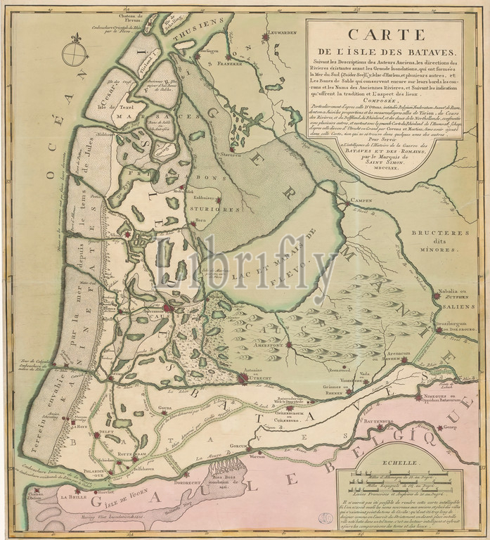
Map of the island of the Batavians, at the time of the Batavian Revolt, Carte de l'isle des Bataves (...) (title on object), Top right title cartouche. Bottom right three scale sticks: Milles d'Allemagne de 15 au degré, Milles espagnols de 17,5 au degré, Lieües francoises et angloises de 20 au degré. Degree distribution along the edges., print maker: anonymous, Maximilien Henri marquis de Saint-Simon, (mentioned on object), 1770, paper, engraving, height 648 mm × width 577 mm
Keywords:
Map, island, Batavians, time, Batavian Revolt, Carte de l'isle des Bataves, title, object, Top right title cartouche, Bottom right three scale sticks, Milles d'Allemagne de 15 au degré, Milles espagnols de 17, 5 au degré, Lieües francoises et angloises de 20 au degré, Degree distribution, edges, print maker, anonymous, Maximilien Henri marquis de Saint-Simon, mentioned, object, 1770, paper, engraving, height 648 mm × width 577 mm
Image ID:
The watermark in the image will not appear on the final download.