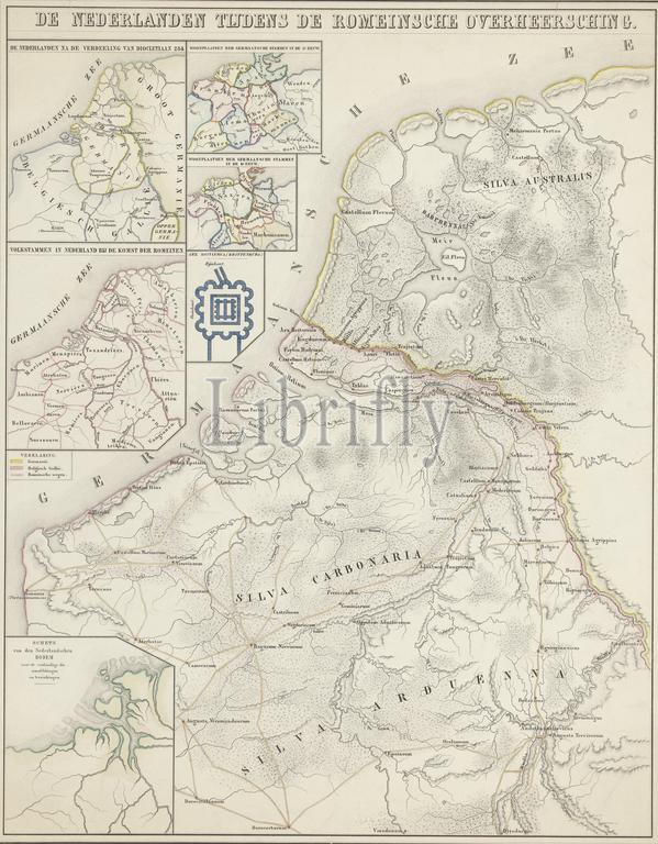
Map of the Netherlands in Roman times, The Netherlands during Roman rule (title on object), Map of the Netherlands in Roman times. With various stakes with division cards and a map of Brittenburg. With the most important Roman roads and the border between Germania and Belgian Gaul. Numbered top right: No. I., print, print maker: Pieter Willem Marinus Trap, (mentioned on object), after drawing by: Willem Jacob Hofdijk, (mentioned on object), Willem Jacob Hofdijk, (mentioned on object), print maker: Leiden, publisher: Amsterdam, 1855 - 1857, paper, height, 640 mm × width, 505 mm
Keywords:
Map, Netherlands, Roman times, Roman rule, title, object, various stakes, division cards, map, Brittenburg, important Roman roads, border, Germania, Belgian Gaul, Numbered top right, No, I, print, print maker, Pieter Willem Marinus Trap, mentioned, drawing, Willem Jacob Hofdijk, Leiden, publisher, Amsterdam, 1855 - 1857, paper, height, 640 mm × width, 505 mm
Image ID:
The watermark in the image will not appear on the final download.