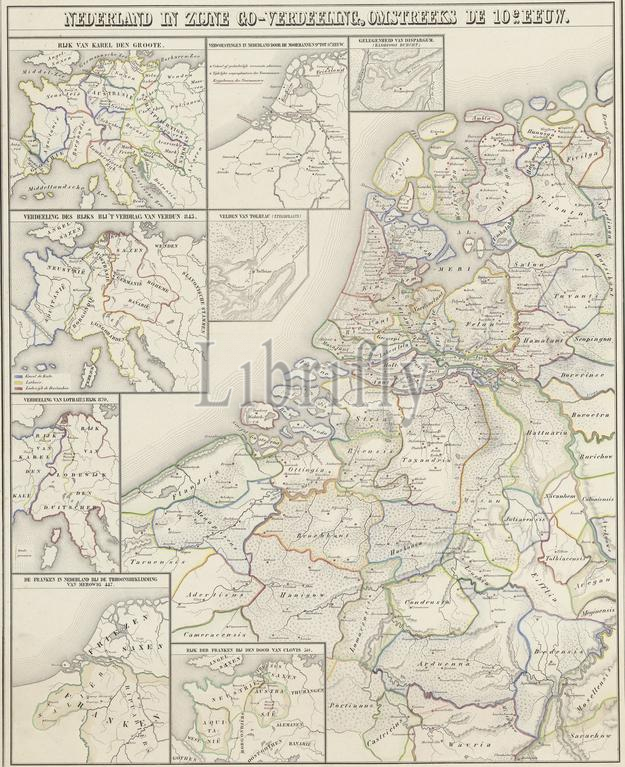
Map of the Netherlands around the tenth century, Netherlands in its Go division, around the 10th century (title on object), Map of the Netherlands around the tenth century. With different stakes with eight division cards of the Netherlands and Europe. The boundaries between the different regions (the "go") are indicated in colors. Numbered top right: No. II., print, print maker: P.J. Fassbender, (mentioned on object), after drawing by: Willem Jacob Hofdijk, (mentioned on object), Willem Jacob Hofdijk, (mentioned on object), Amsterdam, 1855 - 1857, paper, height, 700 mm × width, 535 mm
Keywords:
Map, Netherlands, tenth century, Go division, 10th century, title, object, different stakes, eight division cards, Europe, boundaries, different regions, "go", indicated, colors, Numbered top right, No, Ii, print, print maker, P.J, Fassbender, mentioned, drawing, Willem Jacob Hofdijk, Amsterdam, 1855 - 1857, paper, height, 700 mm × width, 535 mm
Image ID:
The watermark in the image will not appear on the final download.