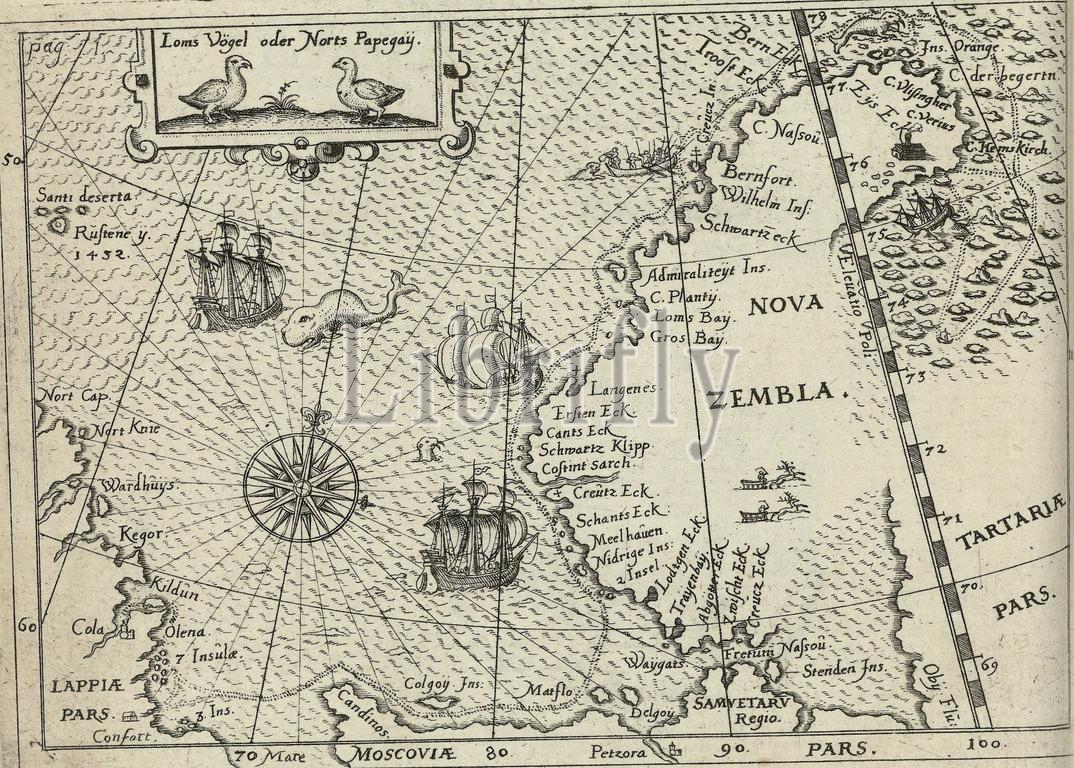
Map of Novaya Zemlya, 1594, Map of the west coast of Novaya Zemlya, the area explored during the first voyage in 1594. At the top a cartouche with two birds. Opposite page 1 in: 'Warfareful Relation. Der dreyen newen uner hörten seltzaamen Schiffart so die Dutch und Seeländischen Schiff....Anno 1594, 1595 und 1596 performed' (1598)., print, print maker: anonymous, after drawing by: Gerrit de Veer, (possibly), publisher: Levinus Hulsius, Neurenberg, 1598, paper, engraving, height, 105 mm × width, 145 mm
Keywords:
Map, Novaya Zemlya, 1594, west coast, area explored, first voyage, top, cartouche, two birds, Opposite page 1 in, Warfareful Relation, Der dreyen newen uner hörten seltzaamen Schiffart, die Dutch und Seeländischen Schiff....Anno 1594, 1595 und 1596 performed, 1598, print, print maker, anonymous, drawing, Gerrit de Veer, publisher, Levinus Hulsius, Neurenberg, paper, engraving, height, 105 mm × width, 145 mm
Image ID:
The watermark in the image will not appear on the final download.