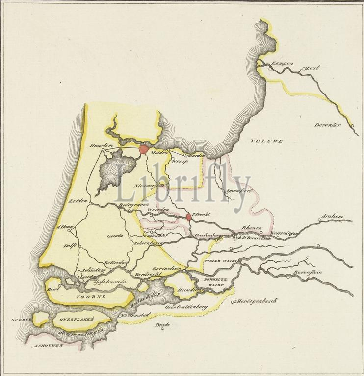
Map of the provinces of Holland, Utrecht and Gelderland showing with colors how far the French had penetrated in 1672 and which parts were protected by inundation, Map of the provinces of Holland, Utrecht and Gelderland showing how far with the colors yellow and red the French had penetrated in 1672 and which parts were protected by inundation., print, print maker: anonymous, after drawing by: Willem Bilderdijk, Netherlands, 1830 - 1853, paper, etching, height, 205 mm × width, 229 mm
Keywords:
Map, provinces, Holland, Utrecht, Gelderland showing, colors, far, French, penetrated, 1672, parts, protected, inundation, colors yellow, red, print, print maker, anonymous, drawing, Willem Bilderdijk, Netherlands, 1830 - 1853, paper, etching, height, 205 mm × width, 229 mm
Image ID:
The watermark in the image will not appear on the final download.