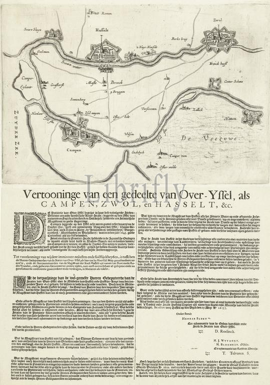
Map of the region between Kampen, Zwolle and Hasselt, 1657, Showing a part of Over-Yssel, as Campen, Zwol, and Hasselt, &c. (title on object), Map of the region in Overijssel between Kampen, Zwolle and Hasselt, following a treaty between these three cities on the leasing of Hasselt's resources, entered into on May 29, 1657. Under the plate with the map is a text printed in 2 columns with the provisions of the treaty numbered 1-8., print, print maker: anonymous, Northern Netherlands, 1657, paper, etching, engraving, letterpress printing, height, 485 mm × width, 355 mm
Keywords:
Map, region, Kampen, Zwolle, Hasselt, 1657, Showing, part, -Yssel, Campen, Zwol, &c, title, object, Overijssel, following, treaty, three cities, leasing, Hasselt's resources, entered, 29, Under, plate, map, text printed, 2 columns, provisions, numbered, 1-8, print, print maker, anonymous, Northern Netherlands, paper, etching, engraving, letterpress printing, height, 485 mm × width, 355 mm
Image ID:
The watermark in the image will not appear on the final download.