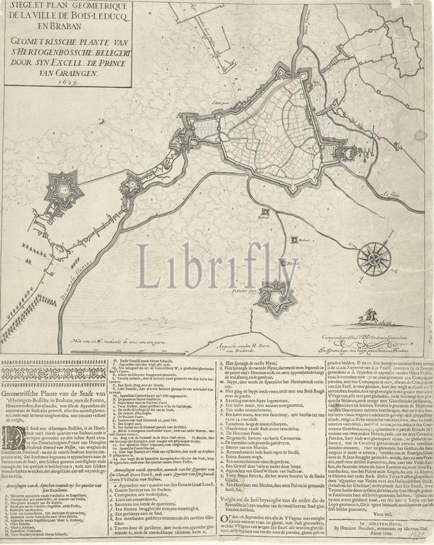
Map of the siege of Den Bosch by Frederik Hendrik, 1629, Siege et plan geometrique de la ville de Bois-leducq en Braban (title on object), Geometrissche plante van s'Hertogenbossche, besieged by syn Excell. the Prince of Oraingen. 1629 (title on object), Map of Den Bosch and surroundings during the siege by the Dutch army under Frederik Hendrik, from May 1 to September 17, 1629. On the right the forts Isabella and Sint-Anthonie, at the bottom Fort Pettelaer. Pasted under the scene is a text sheet with 4 columns of text with a description of the siege and a report of the departure of the Spanish occupiers, the legends A-Y, 2-14, a-y and 2-8 in Dutch., print, print maker: anonymous, publisher: Hendrick Hondius (I), (mentioned on object), Staten-Generaal, (mentioned on object), print maker: Northern Netherlands, publisher: The Hague, 1629, paper, engraving, letterpress printing, height, 438 mm × width, 542 mm
Keywords:
Map, siege, Den Bosch, Frederik Hendrik, 1629, Siege et plan geometrique de la ville de Bois-leducq en Braban, title, object, Geometrissche plante van s'Hertogenbossche, besieged, syn Excell, Prince, Oraingen, surroundings, Dutch army under Frederik Hendrik, 1, September 17, right, forts Isabella, Sint-Anthonie, bottom Fort Pettelaer, Pasted under, scene, text sheet, 4 columns, text, description, report, departure, Spanish occupiers, legends A-Y, 2-14, a-y, 2-8, Dutch, print, print maker, anonymous, publisher, Hendrick Hondius, I, mentioned, Staten-Generaal, Northern Netherlands, Hague, paper, engraving, letterpress printing, height, 438 mm × width, 542 mm
Image ID:
The watermark in the image will not appear on the final download.