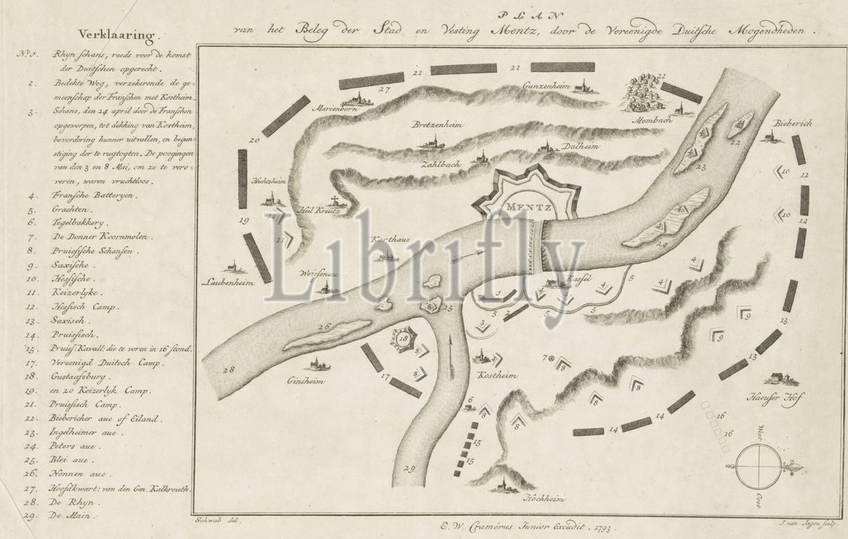
Map of the siege of Mainz by the German armies, 1793, Plan of the Siege of the City and Fortress of Mentz, by the United German Powers (title on object), Map of the siege of Mainz, in French hands, by the combined German armies, April 14 - July 23, 1793. With the positions of the armies. On the left the legend 1-29., print, print maker: Jan van Jagen, (mentioned on object), after drawing by: Schwab, (mentioned on object), publisher: Ernst Willem Cramerus jr., (mentioned on object), Northern Netherlands, 1793, paper, etching, height, 227 mm × width, 352 mm
Keywords:
Map, siege, Mainz, German armies, 1793, Plan, Siege, City, Fortress, Mentz, United German Powers, title, object, French hands, combined German armies, April 14 - July 23, positions, armies, left, legend 1-29, print, print maker, Jan van Jagen, mentioned, drawing, Schwab, publisher, Ernst Willem Cramerus jr, Northern Netherlands, paper, etching, height, 227 mm × width, 352 mm
Image ID:
The watermark in the image will not appear on the final download.