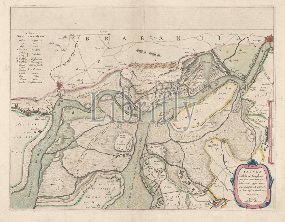
Map of the surroundings of Zandvliet, Tabvla Castelli ad Sandflitam, in terms of simul inundati agri, alluviones, foßæ, alvei, quae Bergas ad Zomam and Antverpiam interjacent, annotantur (title on object), the North on the left, the borders colored, cities, buildings and flags indicated, the roads sometimes populated. Top left explanation of the symbols on the map, center right scale in country miles. Verso: two pages of text, maps of separate countries or regions, Zandvliet, Antwerp, Bergen op Zoom, Willem Janszoon Blaeu, Amsterdam, 1642, paper, watercolor (paint), engraving, h 38.5 cm × w 50.5 cm
Keywords:
Map, surroundings, Zandvliet, Tabvla Castelli ad Sandflitam, terms, simul inundati agri, alluviones, foßæ, alvei, quae Bergas ad Zomam, Antverpiam interjacent, annotantur, title, object, North, left, borders colored, cities, buildings, flags indicated, roads sometimes populated, Top left explanation, symbols, map, center right scale, country miles, Verso, two pages, text, maps, separate countries, regions, Antwerp, Bergen op Zoom, Willem Janszoon Blaeu, Amsterdam, 1642, paper, watercolor, paint, engraving
Image ID:
The watermark in the image will not appear on the final download.