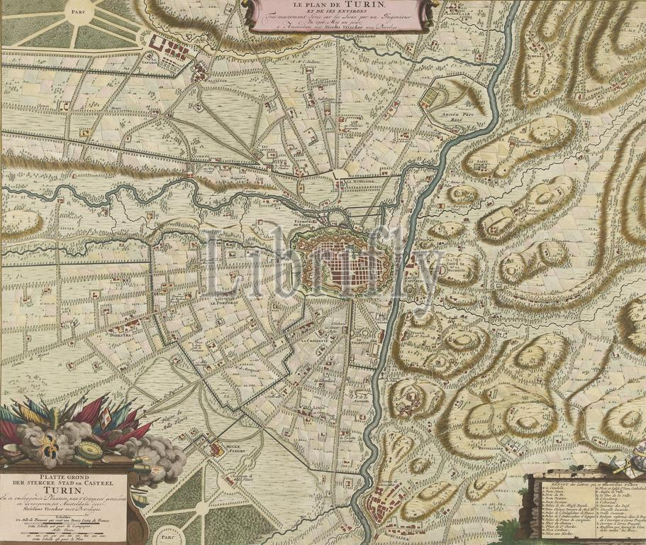
Map of Turin and surroundings, 1706, Le Plan de Turin, et des Environs, Platte Grond der Stercke Stad en Casteel Turin (title on object), Map of the Italian city of Turin and the surrounding area. Turin, besieged by the French, was relieved by the Allies under the Prince of Savoy on September 7, 1706. At the bottom right a cartouche with the legend A-Z in French., print, print maker: Nicolaes Visscher (II), (workshop of), after drawing by: Charles Desbordes, (mentioned on object), publisher: weduwe Nicolaes Visscher (II), (mentioned on object), Amsterdam, 1706, paper, etching, height, 498 mm × width, 588 mm
Keywords:
Map, Turin, surroundings, 1706, Le Plan de Turin, et des Environs, Platte Grond der Stercke Stad en Casteel Turin, title, object, Italian city, surrounding area, besieged, French, was relieved, Allies under, Prince, Savoy, September 7, bottom right, cartouche, legend A-Z, print, print maker, Nicolaes Visscher, Ii, workshop of, drawing, Charles Desbordes, mentioned, publisher, weduwe Nicolaes Visscher, Amsterdam, paper, etching, height, 498 mm × width, 588 mm
Image ID:
The watermark in the image will not appear on the final download.