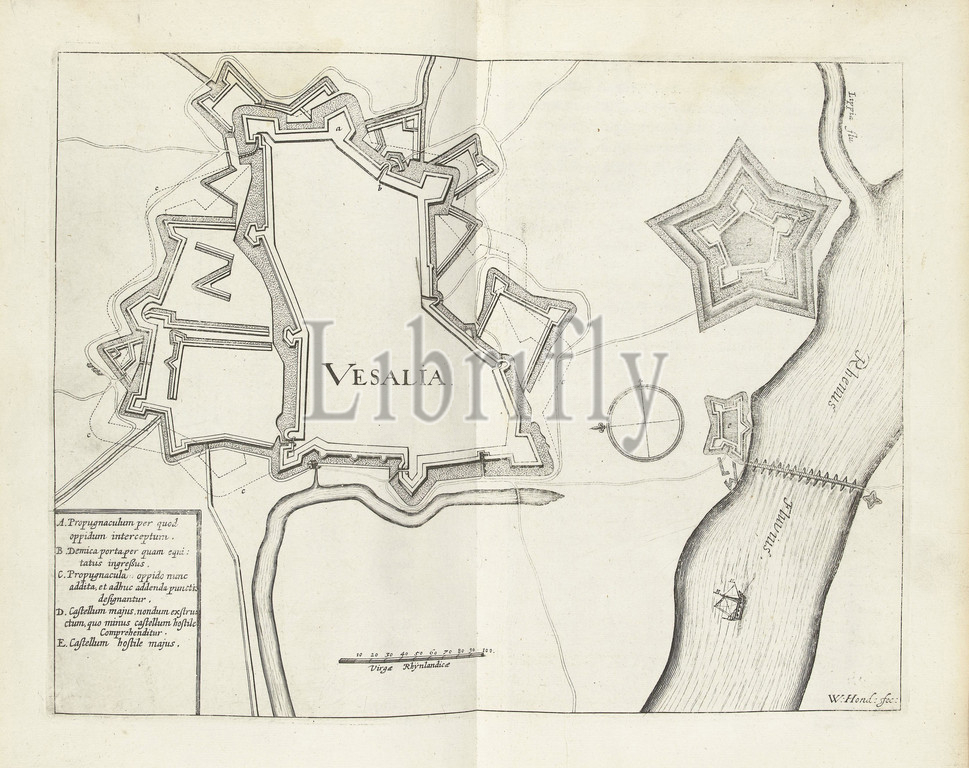
Map of Wesel, 1629, Vesalia (title on object), Map of the city of Wesel, taken by the State army under Frederick Henry, August 19, 1629., print maker: Willem Hondius (mentioned on object), Northern Netherlands, 1629 - 1631, paper, engraving, height 236 mm × width 305 mm
Keywords:
Map, Wesel, 1629, Vesalia, Map, city, Wesel, State army under Frederick Henry, August 19, 1629, print maker, Willem Hondius, mentioned, Northern Netherlands, 1629, 1631, paper, engraving, height 236 mm, width 305 mm
Image ID:
The watermark in the image will not appear on the final download.