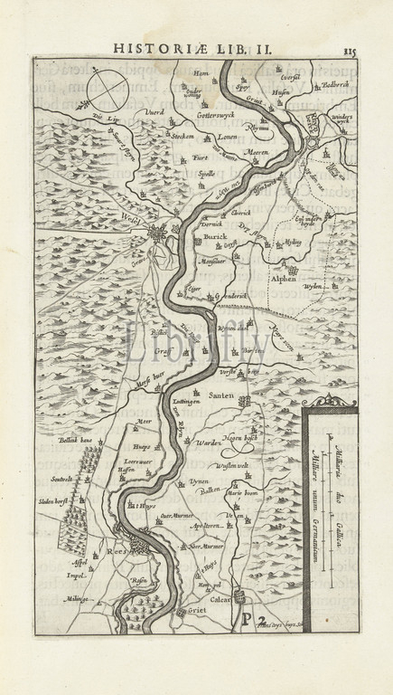
Map of Wesel and its environs, 1629, Tabula agri Vesaliensis (title on object), Map of Wesel and its environs, taken by the State army under Frederick Henry, 19 August 1629., print maker: Francoys Huys (mentioned on object), Northern Netherlands, 1629 - 1631, paper, engraving, height 240 mm × width 137 mm
Keywords:
Map, Wesel, environs, 1629, Tabula agri Vesaliensis, Map, Wesel, environs, State army under Frederick Henry, 19 August 1629, print maker, Francoys Huys, mentioned, Northern Netherlands, 1629, 1631, paper, engraving, height 240 mm, width 137 mm
Image ID:
The watermark in the image will not appear on the final download.