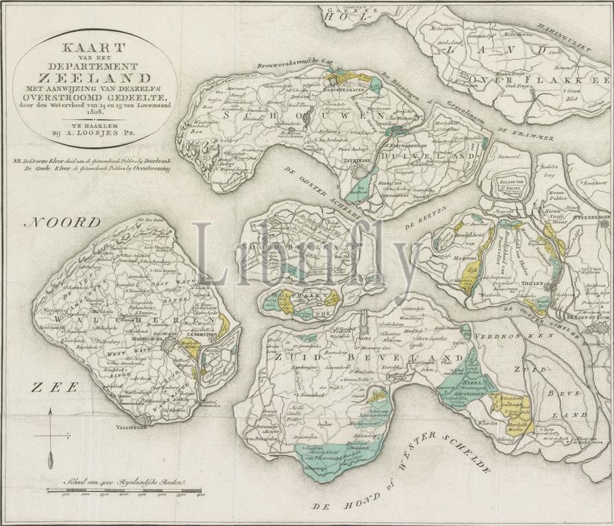
Map of Zeeland with the flooded areas, 1808, Map of the Department of Zeeland with indication of its flooded part, by the flood of 14 and 16 of Louwmaand 1808 (title on object), Map of the department of Zeeland showing the areas covered by the flood of January 14-15, 1808., print, print maker: Daniël Veelwaard (I), (mentioned on object), after drawing by: J.M. Verkuyl, (mentioned on object), publisher: Adriaan Pietersz. Loosjes, (mentioned on object), print maker: Netherlands, publisher: Haarlem, 1808 - 1810, paper, etching, engraving, height, 347 mm × width, 396 mm
Keywords:
Map, Zeeland, flooded areas, 1808, Department, indication, flooded part, flood, 14, 16, Louwmaand 1808, title, object, department, Zeeland showing, areas covered, January 14-15, print, print maker, Daniël Veelwaard, I, mentioned, drawing, J.M, Verkuyl, publisher, Adriaan Pietersz, Loosjes, Netherlands, Haarlem, 1808 - 1810, paper, etching, engraving, height, 347 mm × width, 396 mm
Image ID:
The watermark in the image will not appear on the final download.