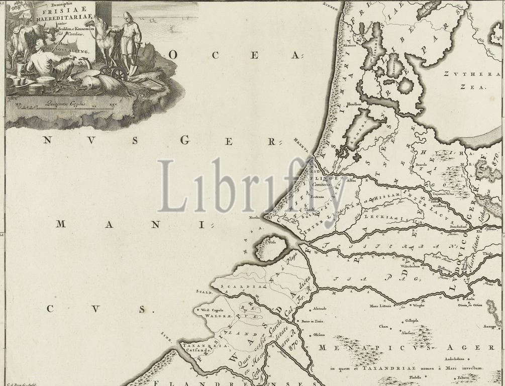
Mulder, Joseph, Amsterdam, Broen, Gerrit de (I), Descriptio Frisiae Haereditariae inter Scaldim et Kinnemum sub Carolinis, Historical map of the Netherlands with the areas of the Batavians and Frisians, Map of the Frisian areas in the western Netherlands. Part of 16 maps of the land of the Batavians and the Frisians first made for and included in M. Alting, Descriptio ant. agri Batavi et Frisii, s. notitia Germ. infer., 2 parts, 1697-1700. Reused in F. Halma, Tooneel der Vereenigde Nederlanden en onderhorige landschape, opened in a general historical, genealogical, geographical and political dictionary, 1725. According to the inscription placed in: Part I, page 335., print, historical print, map, prints, Frederik Muller Historieplaten, height 330 mm, width 430 mm, 1659 - 1740-03-11, print maker, printmaker, 1695 - 1700, fourth quarter 17th century, paper, papier, etching, etchings, engraving, engraving (printing process), Noord-Nederlands, 1658-01-11 - 1718, Work conception, Northern Netherlands
Keywords:
Mulder, Joseph, Amsterdam, Broen, Gerrit de, I, Descriptio Frisiae Haereditariae inter Scaldim et Kinnemum, sub, Carolinis, Historical map, Netherlands, areas, Batavians, Frisians, Map, Frisian areas, western Netherlands, Part, 16 maps, land, Frisians first, included, M, Alting, Descriptio ant, agri Batavi et Frisii, s, notitia Germ, infer, 2 parts, 1697-1700, Reused, F, Halma, Tooneel der Vereenigde Nederlanden en onderhorige landschape, opened, general historical, genealogical, geographical, political dictionary, 1725, According, inscription, placed, in, Part I, page 335, print, historical print, map, prints, Frederik Muller Historieplaten, height 330 mm, width 430 mm, 1659 - 1740-03-11, print maker, printmaker, 1695 - 1700, fourth quarter 17th century, paper, papier, etching, etchings, engraving, printing process, Noord-Nederlands, 1658-01-11 - 1718, Work conception, Northern Netherlands
Image ID:
The watermark in the image will not appear on the final download.