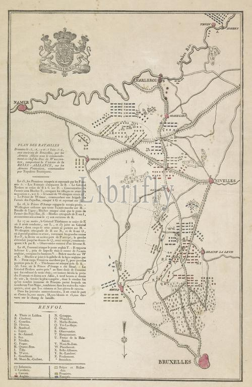
Netherlands, Plan of the Battles Given on 15, 17, 17th and 18th June 1815, in the areas of Brussels, by the Allies under the command of Duke Wellington, representing the Victory of the Belle-Alliance, over the French Armies, commanded by Napoleon Buonaparte, Plan of the Battles of Quatre-Bras and Waterloo, 15-18 June, 1815, verso - stamped, Map of the region between Brussels and Charleroi where between 15-18 June 1815 battles were fought at Ligny, Wavre, Quatre-Bras and Waterloo between the armies of the Allies and the French army under Napoleon. The map shows the battle lines of the armies. With a description of the battles and a legend in French. The different places and armies indicated with colours., print, picture, map, prints, pictures, Frederik Muller Historieplaten, height 380 mm, width 255 mm, print maker, printmaker, 1815 - 1815, paper, papier, etching, etchings, engraving, engraving (printing process), woodcut, letterpress printing, hand colouring
Keywords:
Netherlands, Plan, Battles Given, 15, 17, 17th, 18th June 1815, areas, Brussels, Allies under, command, Duke Wellington, representing, Victory, Belle-Alliance, French Armies, commanded, Napoleon Buonaparte, Battles, Quatre-Bras, Waterloo, 15-18 June, 1815, verso - stamped, Map, region, Charleroi, 15-18 June 1815 battles, fought, Ligny, Wavre, armies, Allies, French army under Napoleon, map, battle lines, description, battles, legend, French, different places, armies indicated, colours, print, picture, prints, pictures, Frederik Muller Historieplaten, height 380 mm, width 255 mm, print maker, printmaker, 1815 - 1815, paper, papier, etching, etchings, engraving, printing process, woodcut, letterpress printing, hand colouring
Image ID:
The watermark in the image will not appear on the final download.