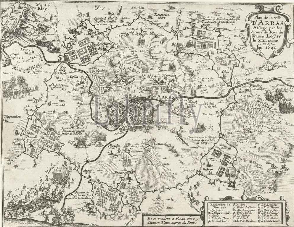
Rouen, Vaux, Damien, Frankrijk, Plan de la ville d'Arras Assiege par les Armes du Roy de France Louis le XIII.iesme Le 12 de Juin. l'an 1640, Siege of Arras by the French, 1640, France, Map of the siege of Arras (Atrecht) by the French on Spain, from 12 or 13 July 1640. Map with the city in the middle, around it the positions of the besieging troops. At the bottom right the explanation of the numbers 1-19 in French., print, prent, nieuwsprent, kaart, prints, prenten, Frederik Muller Historieplaten, height 236 mm, width 306 mm, print maker, prentmaker, 1640 - 1640, second quarter 17th century, tweede kwart 17e eeuw, paper, papier, etching, etsen, engraving, graveren (drukprocedé), Publication (Event), Publicatie, Frans, publisher
Keywords:
Rouen, Vaux, Damien, Frankrijk, Plan de la ville d'Arras Assiege par, les, Armes du Roy de France Louis, le, XIII.iesme Le 12 de Juin, l, 1640, Siege, Arras, French, France, Map, siege, Atrecht, Spain, 12, 13 July 1640, city, middle, positions, besieging troops, bottom right, explanation, numbers 1-19, print, prent, nieuwsprent, kaart, prints, prenten, Frederik Muller Historieplaten, height 236 mm, width 306 mm, print maker, prentmaker, 1640 - 1640, second quarter 17th century, tweede kwart 17e eeuw, paper, papier, etching, etsen, engraving, graveren, drukprocedé, Publication, Event, Publicatie, Frans, publisher
Image ID:
The watermark in the image will not appear on the final download.