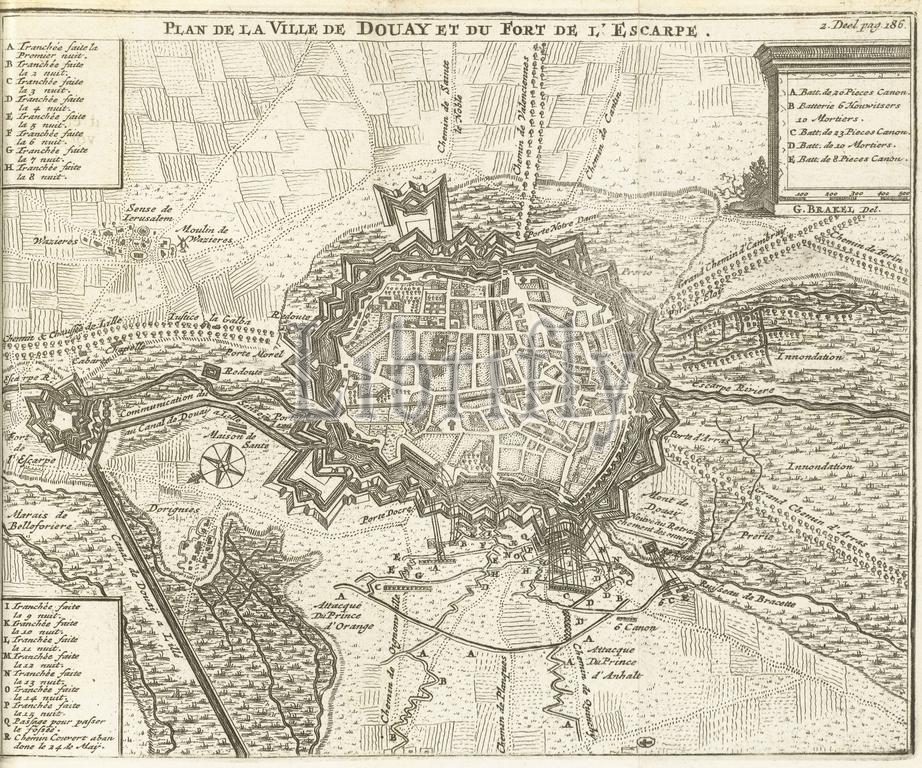
Siege of Douai, 1710, Plan de la Ville de Douay et du Fort de l'Escarpe (title on object), Map of Douai, besieged and taken by the Allies on June 29, 1710. Illustration in the Dutch translation from 1716 by J . Lamigue, The life of Zyne Hoogheit Johan Willem Friso, vol. II, p. 186/187., print, print maker: Matthijs Pool, (possibly), after drawing by: Gillius Brakel, (mentioned on object), publisher: Johannes van Oosterwyk, print maker: Northern Netherlands, publisher: Amsterdam, 1714 - 1716, paper, etching, height, 145 mm × width, 179 mm
Keywords:
Siege, Douai, 1710, Plan de la Ville de Douay et du Fort de l'Escarpe, title, object, Map, besieged, Allies, June 29, Illustration, Dutch translation, 1716, J, Lamigue, life, Zyne Hoogheit Johan Willem Friso, vol, Ii, p, 186, 187, print, print maker, Matthijs Pool, drawing, Gillius Brakel, mentioned, publisher, Johannes van Oosterwyk, Northern Netherlands, Amsterdam, 1714 - 1716, paper, etching, height, 145 mm × width, 179 mm
Image ID:
The watermark in the image will not appear on the final download.