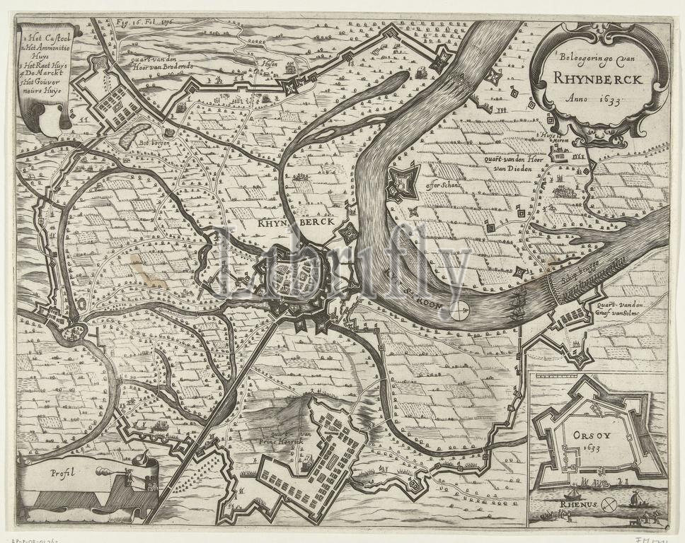
Visscher, Claes Jansz. (II), Northern Netherlands, Siege of Rhynberck Anno 1633, Map of the siege of Rijnberg, 1633, Map of the siege and conquest of Rijnberg by the States army under Frederik Hendrik, 16 May - 2 June 1633. In the center the city of Rijnberg on the Rhine, at the bottom the stadtholder's quarters. Top left a banderole with the legend 1-5 in Dutch. Bottom right an inset with a map of Orsoy. Marked top left Fig. 16. Fol. 176., print, pictorial, historical print, map, prints, pictures, Frederik Muller Historieplaten, height 271 mm, width 345 mm, print maker, printmaker, 1651 - 1652, third quarter 17th century, paper, engraving, engraving (printing process), Work conception, after print by, 1586 - 1652-06-19
Keywords:
Visscher, Claes Jansz, Ii, Northern Netherlands, Siege, Rhynberck Anno 1633, Map, siege, Rijnberg, 1633, conquest, States army under Frederik Hendrik, 16, - 2 June 1633, center, city, Rhine, bottom, stadtholder's quarters, Top left, banderole, legend 1-5, Dutch, Bottom right, inset, map, Orsoy, Marked top, left, Fig, Fol, 176, print, pictorial, historical print, prints, pictures, Frederik Muller Historieplaten, height 271 mm, width 345 mm, print maker, printmaker, 1651 - 1652, third quarter 17th century, paper, engraving, printing process, Work conception, 1586 - 1652-06-19
Image ID:
The watermark in the image will not appear on the final download.